

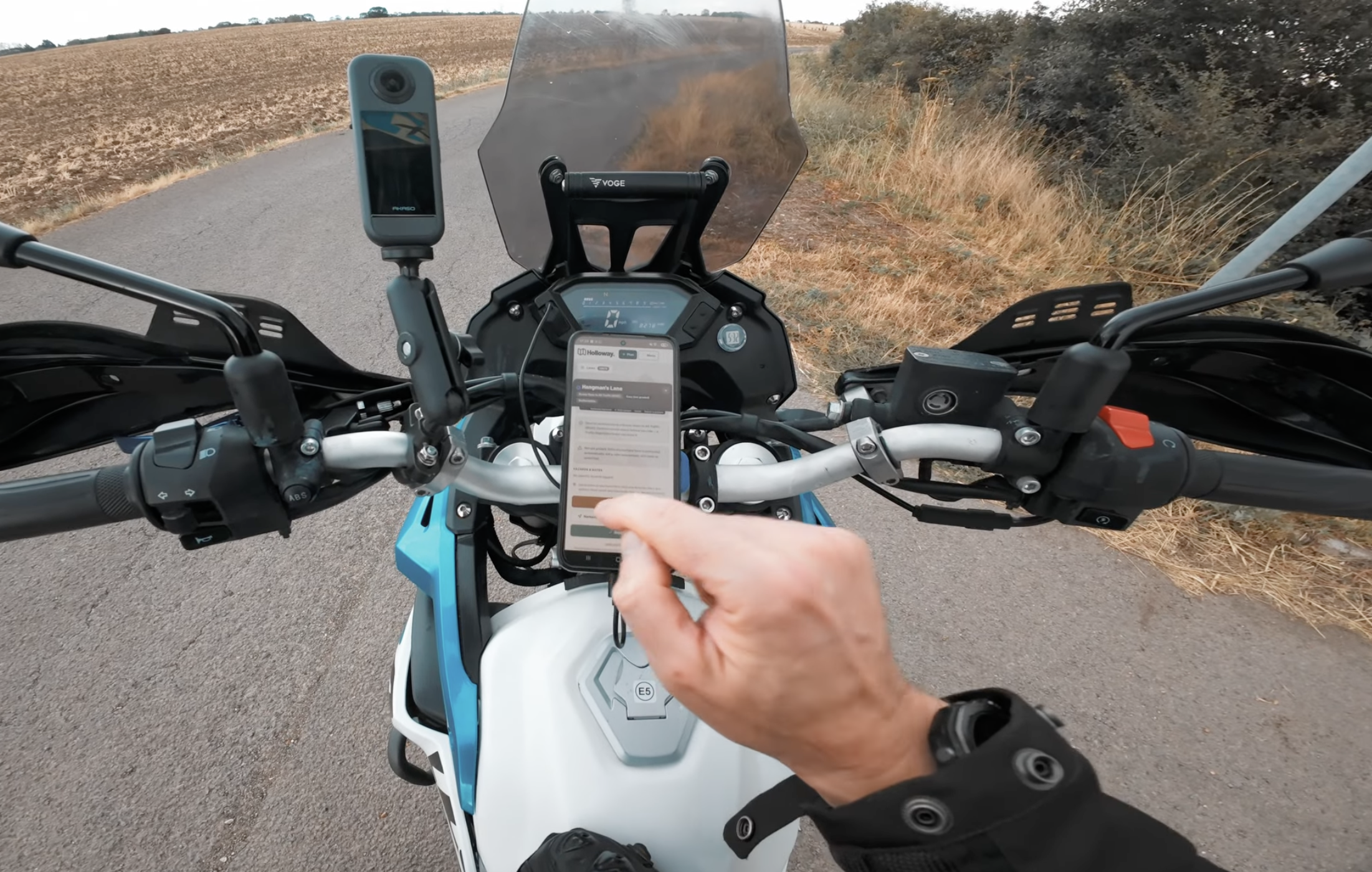
Sooner or later, everyone who gets into trail riding asks the same question: what's actually the best way to find a legal green lane? Not in theory, on a random Tuesday evening, phone in one hand, trying to work out if you can ride somewhere this weekend without ending up on the wrong end of a trespass conversation.
There's more than one answer, and none of them are wrong exactly, they just suit different riders. Here's an honest rundown of the real options, including where Holloway fits and where it doesn't.
The old way: paper maps, forums, and word of mouth
This is how most experienced riders still do at least some of their planning, and it works, if you're willing to put the time in. An Ordnance Survey map shows every right of way in the country, if you know how to read the symbols, and a forum thread or a chat with someone at a meet can fill in the local knowledge no map will ever have.
"Honestly, half of getting into green laning used to be just working out if you were even allowed to be somewhere. I'd be stood at a gate on my phone trying to zoom into some council PDF from 2019, engine running, losing daylight. That's the bit I wanted gone, not the riding, the admin before it."
- Mat Stuckey, founder of Holloway
The real cost isn't money, it's time. Working out whether a track is a BOAT or a restricted byway from a paper symbol takes practice, and there's no way to check whether a Traffic Regulation Order has quietly closed it since the map was printed. What you get is decades of accumulated route knowledge, if you can find the right thread or the right person to ask. What you don't get is a photo of the entrance, a hazard someone logged last month, or any way to check current status without ringing round or digging through a council website yourself. For someone new, that learning curve alone is enough to put a ride off for another weekend.
The TRF's own Green Road Map
The Trail Riders Fellowship, covered in more detail in our piece on what the TRF actually does, maintains its own Green Road Map for members. It's genuinely useful if you're already in a local branch and know the area, built by people with real, on-the-ground knowledge of their own patch.
What membership actually gets you is real branch-level knowledge, people who've ridden a route dozens of times and know exactly which farmer to wave to, plus the access-advocacy work that keeps routes open in the first place, contested TROs, route surveys, the historical evidence work behind Section 53 claims. It's not really built as a quick lookup tool for a rider who just wants to check one lane before heading out, though, it's more of a members' resource tied to that wider access-protection work. Worth having if you're a member already. Not something you'd reach for standing at a fuel stop deciding what to do next.
The Green Lane Association (GLASS) offers a similar members' resource, TrailWise2, a national registry of vehicular rights of way built and moderated by GLASS itself. We've compared what both actually give you against a general nav app in this piece.
TrailVidz
TrailVidz takes a different approach entirely, mapping and grading lanes using video, so you can watch a lane before you ride it. What that gets you is about as honest a preview of a technical section as exists, seeing the actual mud, the actual gradient, rather than trusting someone else's written description of "moderate". That's genuinely useful if you're deciding whether a lane is within your ability. It sits behind a membership, and the format leans toward research you do beforehand rather than something built for checking a lane on the move or planning a route across several of them. We've written a full comparison if you're deciding between the two, TrailVidz alternative: how Holloway compares.
Find Green Lanes
A newer, OSM-based map that's grown into a genuinely social, feature-rich tool of its own, route planning, GPX export, live-follow tracking and community ratings from other riders. We've written a full comparison, Find Green Lanes vs Holloway, if you're weighing the two up specifically.
Where Holloway actually fits
Holloway was built around a much narrower question: can I ride here, right now, and how do I get there. Not a full research project, not a video library, just an answer.
- Every legal green lane shown on one map, colour-coded so a BOAT and a restricted byway never look the same
- Full lane detail at a glance: length, difficulty, surface, and hazards other riders have actually logged
- Street view on lanes where it's available, so you can see what the entrance actually looks like before you get there
- Video links riders have added for specific lanes, if you want to see one ridden before you commit
- Points of interest along the way, historic sites and landmarks worth a detour, not just the lane itself
- A one-tap Legal Status Search on every lane, pointing straight at the council's current traffic notices
- Navigate straight to any lane's start with real turn-by-turn directions, no working out your own route there
- Plan a full day linking several lanes together, download it for offline use, and navigate live while riding
- No account needed to browse, check legal status, or see hazards other riders have reported
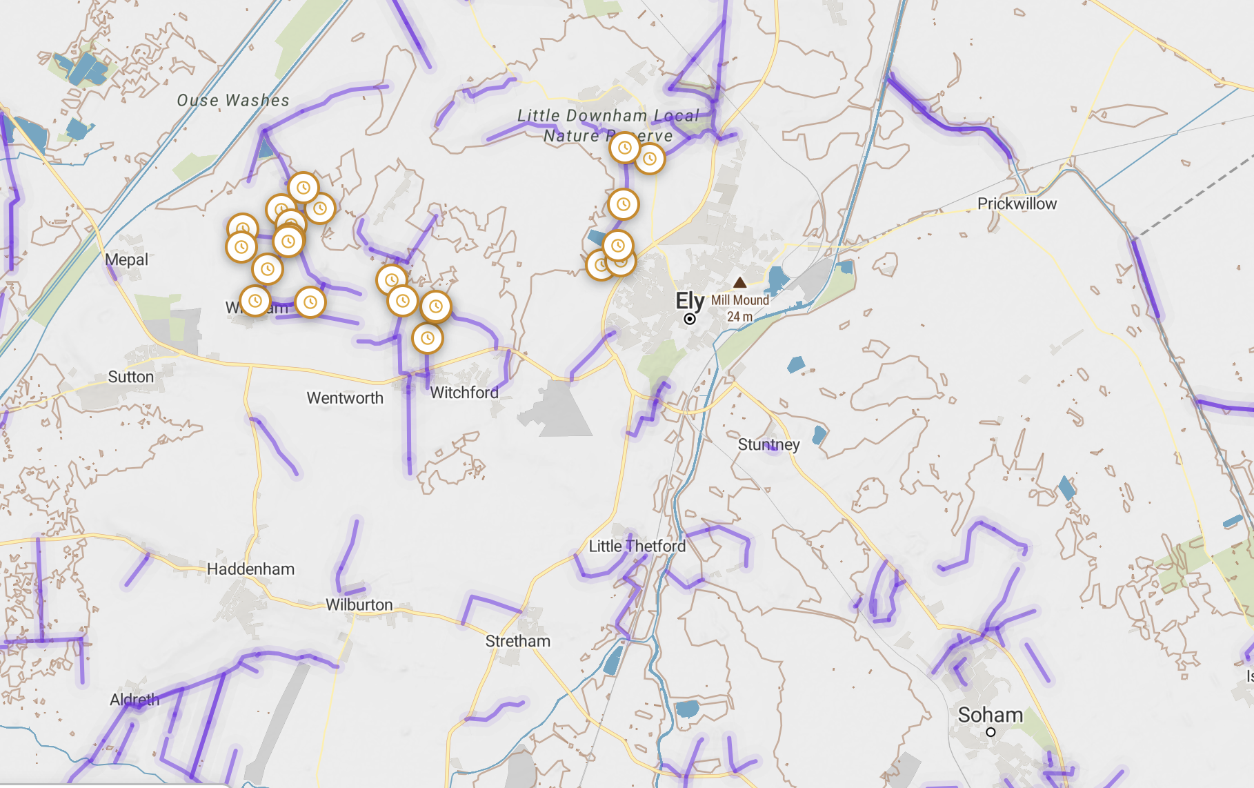
The main map. BOATs, restricted byways and the rest are all colour-coded so you never mix up what you can and can’t ride.
More than just a line on a map
A lane's detail page is built to answer the questions you'd normally only find out by actually going there. Street view, where Google's actually covered the area, lets you see what the entrance looks like before you commit to it, useful when a gate or a junction is easy to miss on a first visit. If another rider's added a video of the lane, that's right there too, the same idea TrailVidz is built entirely around, just as one extra thing to check rather than the whole product. And if there's something worth knowing nearby, an old drove road's history, a ruin, a view worth the detour, that shows up as a point of interest on the map as well, because a day out is usually about more than just the lane itself.
Every lane's detail card also carries a one-tap Legal Status Search, a pre-filled search pointing straight at the relevant council's current traffic notices, so you're not starting from nothing trying to work out where a TRO would even get published.
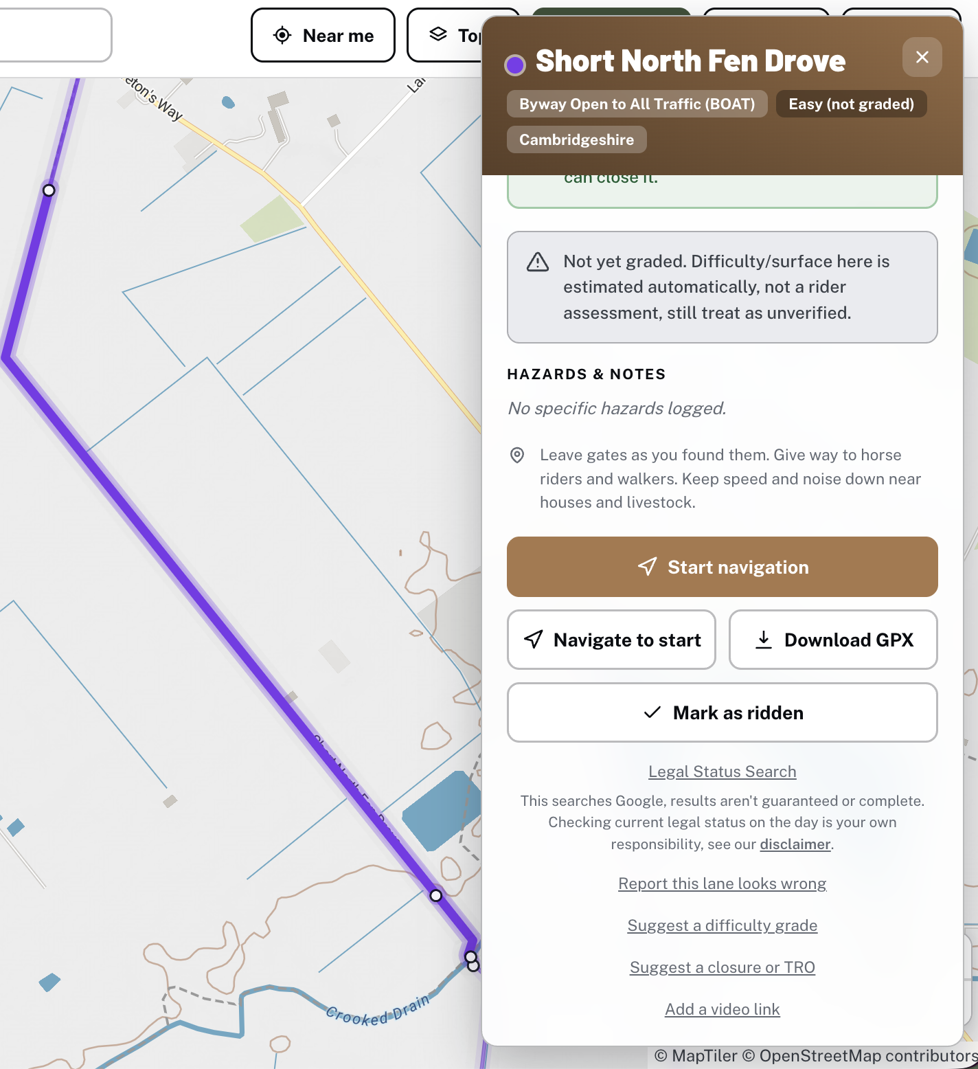
A lane’s detail card, with Legal Status Search one tap away.
Here's how the main options actually stack up for someone deciding where to start:
| Option | Cost | Best for | Where it falls short day to day |
|---|---|---|---|
| OS map + forums | Cost of the map | Deep local knowledge, no signal needed | Slow, no live closure or TRO info, steep learning curve |
| TRF Green Road Map | TRF membership, around £58/year | Members with area knowledge, access advocacy | Built for members, not a quick check-and-go tool |
| TrailVidz | Membership | Judging difficulty on video before you commit | Research tool more than an in-the-field app |
| Holloway | Free to browse, £20/year for planning & navigation | Finding, checking and getting to a lane fast, from your phone | Not a substitute for years of local branch knowledge, if you've already got that |
Once you've worked out where you're headed, getting there is just as quick. Tap Navigate to start and Holloway hands you straight to Google Maps for real turn-by-turn directions to the lane's entrance, no working out your own route there first.

Navigate to start, real turn-by-turn directions straight to the lane.
For a full day out, Plan Route lets you string several lanes together in order, see the whole route on one map, and download it for offline use once you're out of signal, then follow it with live navigation on the day.
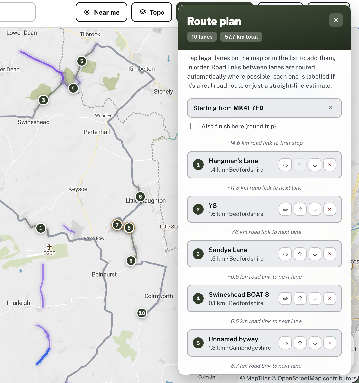
A planned route, several lanes strung together into one day out.
Who Holloway is actually for
People getting into trail riding who don't want to learn a new skill just to find a legal place to ride. Riders who want to check somewhere new on the way there, not the night before on a laptop. Anyone who wants one simple app that covers finding a lane, checking it, and getting to it, without stitching together three different tools to do it.
It might not be the right fit for everyone, if you've already got years of local knowledge and a TRF branch you ride with every month, you probably don't need convincing either way. Holloway's built for the day to day, the quick check before a ride, the on-the-go decision, not a replacement for that kind of experience.
What it actually costs
Browsing the map, checking legal status, seeing hazards and closures, that's free, no account needed. Planning a route, downloading it offline, and navigating live comes under Holloway Premium, £20 a year, in line with what TrailVidz charges for its own membership. A pound from every subscription goes straight back into keeping lanes open and maintained, not just funding the app.
If you've been putting off your first proper green lane because working out where to even look felt like its own project, that's the exact gap this was built to close. Have a look at what's near you, browsing is free and there's more out there than most riders realise.