
Can you ride the Ridgeway on a motorbike?
Partly.
- 11 km of the Ridgeway is a byway or unclassified road open to motorcycles all year.
- Another 23 km is closed to motor vehicles from 1 Oct to 30 Apr by a seasonal order, and open the rest of the year.
- 0.6 km is closed to motor vehicles by a traffic order.
- 93 km is a restricted byway, bridleway or footpath, with no right to ride a motorbike.
- 11 km follows public roads, which you can ride but aren’t green lanes.
The Ridgeway, end to end
The whole route straightened out, from Overton Hill, near Avebury (top left) to Ivinghoe Beacon, coloured by what you can legally ride.
- Open to motorcycles 11 km
- Seasonal closure 23 km
- Closed to motor vehicles 0.6 km
- Restricted byway, no motors 36 km
- Footpath, bridleway or path 57 km
- Public road 11 km
- Track, no recorded right of way 0.3 km
On the map
A is the start, B the end. The same colours as the strip above.
See every lane’s name, surface and current status.
Open the live map →Section by section
Every stretch of byway along the route, in order. Distances are from Overton Hill, near Avebury.
-
0.1to 9.4 km
From near East Kennett to near Broad Hinton
-
9.4to 15.8 km
Smeathe's Ridge6.4 km
From near Broad Hinton to near Ogbourne St Andrew
-
16.1to 19.0 km
Old Chase Road2.9 km
Near Ogbourne St Andrew
-
19.4to 22.1 km
Unnamed byway2.7 km
From near Ogbourne St Andrew to near Chiseldon
-
26.8to 30.2 km
The Ridgeway3.4 km
From near Hinton Parva to near Bishopstone
-
30.2to 58.2 km
The Ridgeway and Old Street, White Way28 km
From near Bishopstone to near East Ilsley
-
58.2to 64.8 km
The Ridgeway6.5 km
From near East Ilsley to near Aldworth
-
89.6to 97.4 km
Icknield Way7.8 km
From near Cookley Green to near Postcombe
-
102.8to 103.7 km
Upper Icknield Way0.9 km
Near Bledlow
-
109.0to 110.4 km
Upper Icknield Way1.4 km
From near Horsenden to near Princes Risborough
-
127.2to 127.7 km
Unnamed byway0.5 km
From near Buckland Common to near Cholesbury
What riding it is like
Holloway Premium
Ride the Ridgeway as one route
- Link its open lanes with real road connections between them
- Export GPX for your GPS unit or phone app
- Live navigation on a bar-mounted phone
- Seasonal closures shown on the dates they apply
£1 from every membership goes toward keeping lanes open.
Closures and orders on the route
Every restriction we’ve found on lanes along the Ridgeway. Tap one for the details.
-
The RidgewaySeasonal, 1 Oct to 30 Apr
Seasonal vehicle restriction, closed Oct to Apr (from OSM tagging, verify locally).
-
Unnamed sectionSeasonal, 1 Oct to 30 Apr
Seasonal vehicle restriction, closed Oct to Apr (from OSM tagging, verify locally).
-
Upper Icknield WaySeasonal, 1 Nov to 30 Apr
Buckinghamshire Council (Byways Open to All Traffic Nos. 7 and 8, Parish of Princes Risborough) (Prohibition of Driving) Order, closed 1 November to 30 April each year, open 1 May to 31 October. No motorcycle exemption stated.
-
Old Chase RoadSeasonal, 1 Oct to 30 Apr
Seasonal vehicle restriction, closed Oct to Apr (from OSM tagging, verify locally).
A snapshot, not a live feed. Researched from council and park authority orders, last built 9 October 2026. Check each lane’s current status in the app before you ride.
About the Ridgeway
- Often called Britain’s oldest road: people have travelled this chalk ridge for at least 5,000 years.
- Today it is one of England’s National Trails, running from Overton Hill near Avebury to Ivinghoe Beacon in the Chilterns.
- It passes the Uffington White Horse, Wayland’s Smithy long barrow and Barbury Castle hillfort.
Ride it well
- Walkers, horse riders and cyclists use it too. Slow right down and stop the engine for horses.
- Ride in small groups, stay on the line of the lane, and don’t ride a soft surface that you’d rut.
- Seasonal orders exist to stop winter damage, and lanes stay open when riders respect them.
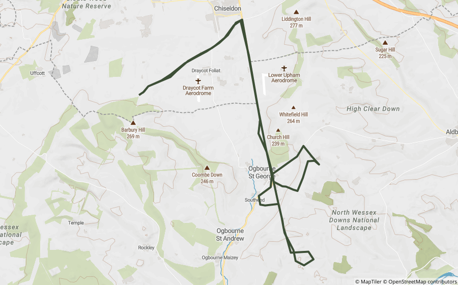
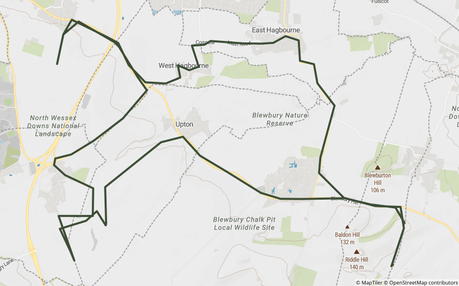
Ready-made GPX routes nearby
Holloway loops that use lanes on or close to the Ridgeway.
Places along the way
Historic sites and landmarks within a mile or so of the route. Access not checked, look before you visit.

A natural history museum built from Lord Rothschild's private collection, now part of the Natural History Museum, London.

A Grade II* listed windmill thought to date from the early 17th century, one of the oldest in Britain.

A prominent Chiltern Hills landmark and Iron Age hillfort site, 233m above sea level.

Woodland around Haddington Hill, the highest point in Buckinghamshire.

A 79-acre site of special scientific interest north of Bledlow Ridge.

The official country residence of the UK's prime minister, a 16th-century manor house.

A cross-shaped chalk hill carving on Whiteleaf Hill near Princes Risborough.

An early Iron Age round barrow on the Ridgeway National Trail.

A perforated sarsen stone at Kingston Lisle that produces a horn-like sound when blown.
A Grade II* listed Georgian country house near Wantage.
Questions riders ask
Can you ride the Ridgeway on a motorbike?
Partly. 11 km of the Ridgeway is a byway or unclassified road open to motorcycles all year. Another 23 km is closed to motor vehicles from 1 Oct to 30 Apr by a seasonal order, and open the rest of the year. 0.6 km is closed to motor vehicles by a traffic order. Legal status changes, so check each lane’s current status before you ride.
Is the Ridgeway open to motorbikes in winter?
Not all of it. 23 km is under seasonal orders that close it to motor vehicles from 1 Oct to 30 Apr. The rest of the open lanes stay open all year, subject to any temporary closure.
How long is the Ridgeway?
The Ridgeway runs about 138 km from Overton Hill, near Avebury to Ivinghoe Beacon, measured along its mapped line.
Is there a GPX route for the Ridgeway?
2 ready-made Holloway GPX routes use lanes on or near it, linked on this page. Downloading them, or building your own along the Ridgeway, is part of Holloway Premium.
Ride the Ridgeway with Holloway
Every lane along it, with its legal status and hazards, is on the Holloway map, free with a quick email sign-in.
Open the map, free Or plan a route along it with PremiumRoute lines and lane data from OpenStreetMap contributors (ODbL) and council rights of way records via rowmaps.com. Contains public sector information licensed under the Open Government Licence v3.0. Contains OS data © Crown copyright and database rights 2026. Reference only: legal status changes, check signage and current Traffic Regulation Orders before riding. How we check this data.