


The gap most tools leave

Knowing a lane is legal and graded moderate tells you almost nothing about whether it fits into a sensible day. You need to know how far it is from the last lane, whether there's a garage between the two, what the road connector actually looks like, and what happens if the third lane on your list turns out to be closed or flooded when you get there. A list of individually good lanes doesn't automatically make a good day. That only comes from the plan that links them.
Build the loop, not just the lanes

Start with a rough shape. A loop that returns you to your start point, or at least close to it, is almost always more practical than an out-and-back or a point-to-point that leaves you needing a lift or a long road ride home at the end of a long day. Pick a starting town with fuel and parking, then work outward.
Look for lanes that cluster within a reasonable radius of each other, joined by minor roads rather than A-roads. The road sections matter more than people expect. A connector that looks like five minutes on the map can be twenty minutes of single-track lanes behind a tractor, and that adds up across a full day.
Account for the hardest section before you commit to the day
Plan around your worst lane, not your average one. If four lanes are straightforward and the fifth is a genuinely difficult clay climb, that fifth lane sets the tone for the whole day, because it's the one that can go wrong, take longest, or force a change of plan. Ask what that lane needs from you and the bike, and ask it honestly, not optimistically.
This is also where checking current conditions actually matters. A lane that's fine in June can be a different proposition after a wet week, and grading alone won't tell you that on the day. Read the lane properly before you're committed to riding it, using whatever recon you can do beforehand.
Total distance matters too, and not just lane mileage. Add up the road miles between lanes, the miles to your first lane and home from your last, and check that against your fuel range and the group's realistic pace. A day that looks like 40 miles on paper can easily become 90 once the connectors are in.
Build in a bail-out
Every plan needs an honest exit. That means knowing, before you set off, which point in the loop lets you cut back to a road and get home if someone's tired, the weather turns, or a lane you were relying on is closed when you arrive. It's worth marking this on the route rather than working it out under pressure at 3pm with wet gloves on.
A bail-out isn't a sign the day's been planned badly. It's a sign it's been planned properly. The lanes that catch people out are rarely the ones on the plan, they're the ones ridden anyway once the original plan has quietly fallen apart.
The role of a combined GPX

Once you've got a loop that makes sense, having it as a single GPX file, lanes and road connectors together, is what actually makes the day work on the ground. It means you're not stopping at every junction to check a paper map or flick between separate lane entries on a phone. One file, one line to follow, with the road sections joined up properly rather than left as gaps you have to guess at.
This is the piece that separates a lane list from a route. Anyone can find five legal lanes in a county. Turning them into something you can actually navigate, with fuel stops and a bail-out built in, is the harder and more useful job.
A worked example: a day route built like this in Bedfordshire
Bedfordshire is where Holloway started, and its mix of chalk ridgeline and clay vale makes a decent illustration of how this comes together, even without naming specific lanes as currently open, since legal status changes and always needs checking on the day.
A route built like this might start from a small town with a garage and a car park, heading out on B-roads to a cluster of legal byways along a chalk ridge, where the going is generally firmer and faster. From there, road connectors drop down off the ridge toward the clay vale, where the second cluster of lanes sits, generally slower and more seasonal, best treated with more caution outside summer. A lunch stop in a village roughly at the halfway point gives a natural point to reassess: how the group's doing, how the lanes have been running, whether to continue the full loop or cut back early. The return leg loops back toward the start on minor roads, picking up one or two shorter lanes on the way if time and energy allow, with a clearly marked bail-out road available from the lunch stop onward.
The shape matters more than the specifics: outbound cluster, natural reassessment point, return leg with an exit built in. That structure works whether you're building a loop in Bedfordshire, the Chilterns, or further out in the Yorkshire Dales.
"The best days I've had on lanes were never about finding one brilliant byway. They were about a loop that flowed, with an easy lane to warm up on, a proper test in the middle, and enough slack in the plan that a closure or a bad ford didn't wreck the whole day."
— Mat Stuckey, founder of Holloway
Plan it properly, then check it on the day
Before you ride any of it, check current legal status and closures. UCRs in particular are worth a second look, since being on a council's list of county roads doesn't by itself carry the same confirmed statutory right as a BOAT, so it's worth checking status rather than assuming. And whatever the plan says, read each lane's actual condition when you arrive rather than trusting the plan blindly.
It's also worth packing properly for the day you've actually planned, not just the day you hope for. A kit list built around what a full day genuinely needs is a good place to start, alongside knowing how to read the difficulty grade of each lane on your route properly rather than at face value.
Where Holloway fits
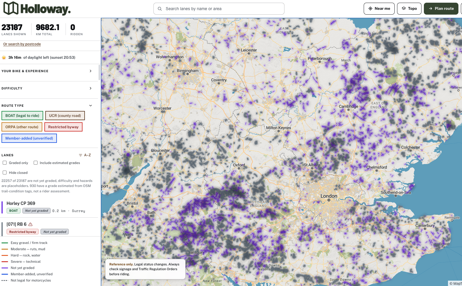
Holloway's free to use for exactly this kind of planning groundwork: browse the map, search by area, filter by bike and experience, and see every legal lane's name, legal type, difficulty, length, hazards and current closure or TRO status, no account needed. The harder part, actually stringing lanes into a route with proper road connectors, is where Holloway Premium comes in. For £20 a year it adds full route planning with real road-following connectors, GPX export for your GPS, exact coordinates, live weather, and navigate-to-start, so the day you plan on the sofa is the day you can actually ride. Plan the route on Holloway before you go.