

An experienced rider rarely turns up at a lane cold. Most of the real work happens before the ride, at a kitchen table with a map and a phone, and it's the reason experienced riders get caught out far less often than they should on paper.
Why a bit of planning saves a whole day
A lane that looks straightforward on a map can turn out to be axle-deep clay, a flooded ford, or a dead end blocked by a fallen tree. Any one of those can turn a planned day into a short, frustrating one, or worse, into a recovery situation on ground that isn't easy to get help to. A proper recon session before you leave catches most of this in advance, for the cost of an evening rather than a wasted Saturday.
This isn't about eliminating risk entirely, green laning always carries some unpredictability. It's about removing the risks that were entirely foreseeable if you'd looked properly beforehand.
Reading a map for surface and gradient clues
An OS map tells you more than most riders use it for. Contour lines close together mean a steep climb or descent, and steep sections on clay or wet chalk behave very differently to the same gradient on compressed stone. Blue lines crossing the route mark streams or rivers, a strong hint at a ford, even if it isn't marked as one explicitly.
Vegetation symbols, marshland markers and the general shape of the surrounding land all add context. A lane running along a valley bottom near a watercourse is a reasonable bet for standing water after heavy rain, well before you've checked anything else.
Satellite view for current condition

Maps show the route. Satellite imagery shows something closer to current reality, standing water, overgrowth, recent erosion or a section that's clearly been churned up by other traffic. It's not perfect, imagery can be months or years old, but it's a genuinely useful second opinion on top of the map.
Look for colour changes along the route, darker patches often indicate wet ground, and gaps in tree cover can reveal a lane's actual width where a map symbol alone doesn't tell you much.
Time of year and recent weather
The same lane can be a pleasant, firm ride in August and genuinely difficult by November. Rutted clay in particular changes character completely between a dry summer and a wet autumn. Check what the weather has actually been doing in the area over the past week or two, not just the forecast for the day you're planning to ride, since ground takes time to dry out after sustained rain.
Upland routes across the Peak District, Yorkshire Dales and Exmoor hold water and mud for longer after rain than lowland lanes do, and exposed sections catch wind and weather that sheltered valley routes avoid entirely. Factor the season into difficulty, not just the lane's baseline rating.
Reading approaches and exits
The hardest part of a lane is sometimes not the lane itself but getting on or off it. A tight gate, a steep entry track, or an exit onto a busy road all deserve a look before you commit. A lane rated easy in the middle can still have a genuinely awkward entrance that catches out someone who only checked the main route.
Spotting water crossings in advance
Fords and stream crossings are one of the most common places for green laning days to go wrong, and one of the easiest things to check for in advance. A ford that's a shallow, firm crossing in August can be axle-deep and fast-flowing by November, and depth isn't always obvious from a map or from satellite imagery alone.
Where a crossing is marked, treat it as something to verify on the day rather than assume from a previous visit or someone else's report. Water levels change quickly after rain, and a crossing that was fine last week isn't a guarantee for today.
Where Holloway fits into this

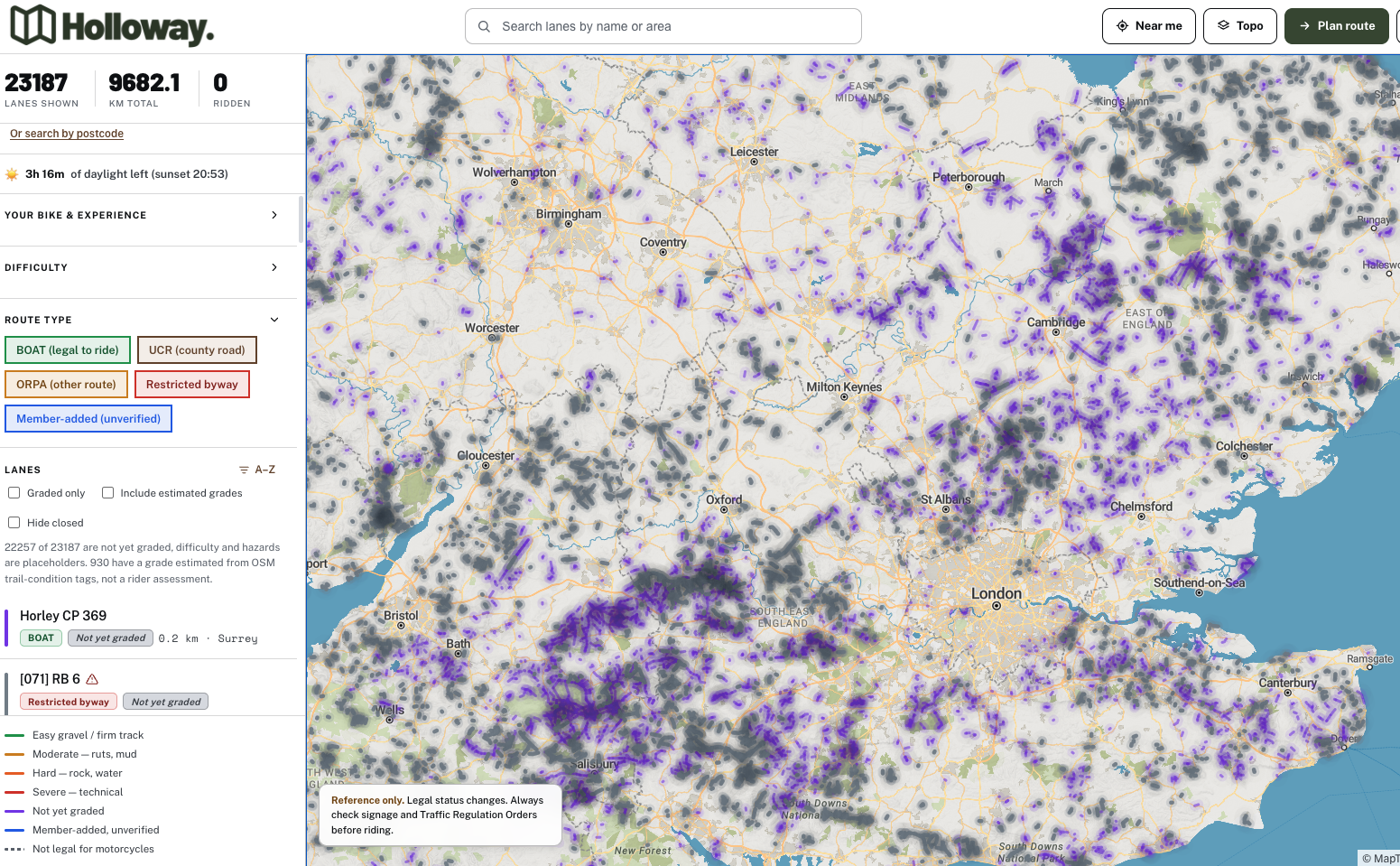
Recon works best when you're not starting from a blank map. Holloway shows every legal green lane in England and Wales, its difficulty rating, length and known hazards, free to browse with no account needed, which gives you a solid starting point before you add your own map reading and satellite checks on top.
Holloway Premium adds surface type, exact coordinates and live weather, useful for confirming ground conditions closer to the day, alongside full route planning that connects lanes with road-following routes and exports the whole thing as a GPX file for your GPS.
"The question I ask before any new lane is simple: what does this look like after a week of proper rain? If I can't answer that with any confidence, I haven't done enough homework yet."
— Mat Stuckey, founder of Holloway
The one question every experienced rider asks
Before committing to a lane they haven't ridden, most experienced riders ask themselves some version of the same thing: what's my way out if this goes wrong halfway through? Knowing the answer, whether that's a nearby exit, a turning point, or simply confirming there's phone signal at the halfway mark, is what separates planning from guessing.
Pair this recon approach with a sensible kit list, covered in our guide on what to pack for a day of green laning, and you've done the two things that matter most before wheels touch mud.
Plan properly, then ride
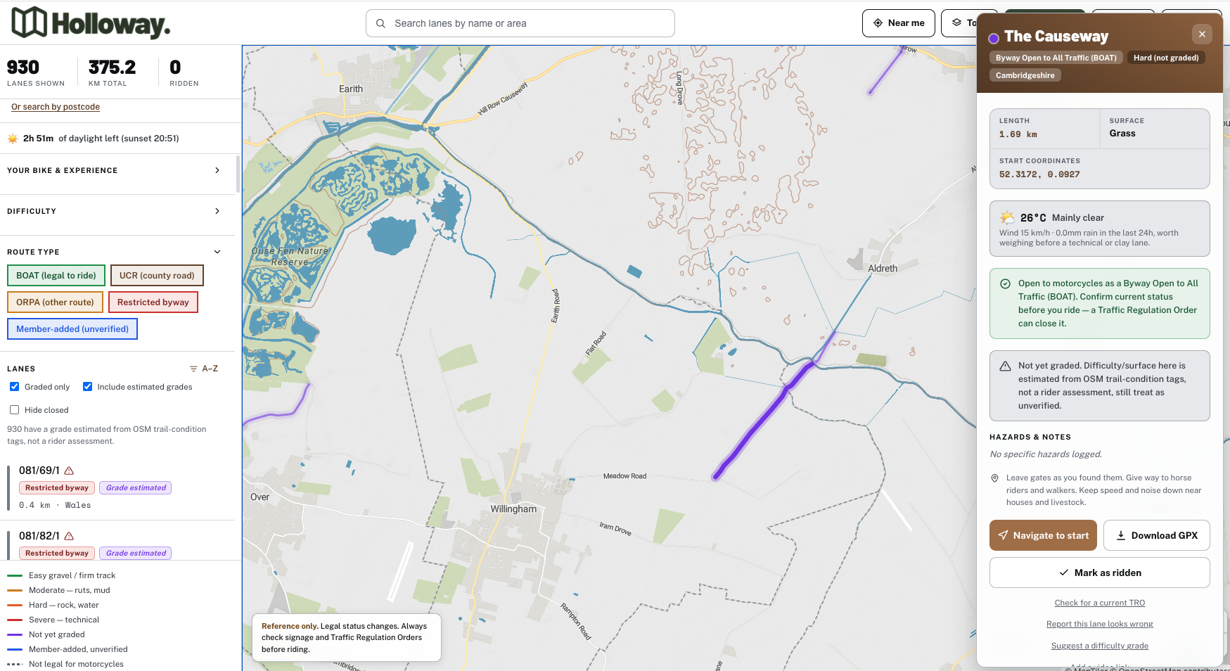
Holloway is a modern, simple tool to find legal green lanes, byways and more across England and Wales, free to browse, with difficulty, hazards, length and current status, all without needing an account. For £20 a year, Holloway Premium adds surface type, exact coordinates, live weather and full route planning with road-following connectors between lanes, plus GPX export, so recon turns into a proper route you can take offline and ride with confidence.